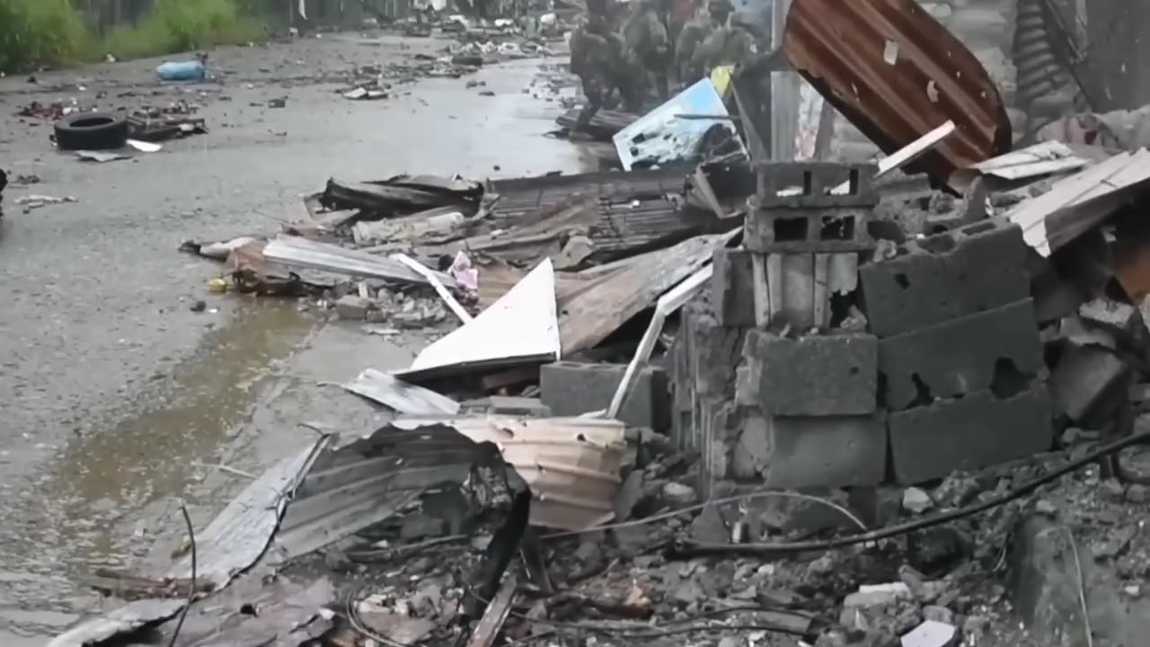
For those curious, there are a few sections of Marawi viewable on Google maps street view of the area where some of the fighting took place. The images were taken 4-6 years *after* the siege.
It’s a strange and sad sight of warnings about unexploded ordinance, political ads, congratulatory billboards, mangled overgrown buildings, and a few families still making it their home.
babushka45 on
The vid shows a mix of troopers from the 1st Infantry Division (note the Red inverted triangle Tabak patch of those who used the recoilless rifle) and the Scout Rangers (with the SOCOM arrow and black panther patch).
Ah yes, those Bulgarian RPGs and their first field usage. Airtronic USA was going to be the supplier for the AFP but they were unable to uphold the tender. They used fragmentation rounds during this video hence the tiny warhead.
To those seeing M113s in the video having wooden armor, please do note that the Army were facing IS militants armed with bootleg RPG-2s with improvised warheads.
Also, Marawi was the largest urban battle since the Battle of Manila in 1945, Zamboanga in 2013 and Jolo in 1974 were relatively smaller in scope. The 1st Infantry Div are experts in counter insurgency but not in urban warfare and after this battle improved MOUT training were instituted.
Secondstoryguy6969 on
The 1940s called, they want their bazooka back….
RelationshipNo615 on
This feels like the Philippines Version of the Battle of Hue City .

4 Comments
For those curious, there are a few sections of Marawi viewable on Google maps street view of the area where some of the fighting took place. The images were taken 4-6 years *after* the siege.
Go forward & take a left on the first main road:
https://www.google.com/maps/@8.0047005,124.293964,3a,75y,125.35h,91.83t/data=!3m7!1e1!3m5!1sg7IjkVy-E8k6MgFkOxKsUw!2e0!6shttps:%2F%2Fstreetviewpixels-pa.googleapis.com%2Fv1%2Fthumbnail%3Fcb_client%3Dmaps_sv.tactile%26w%3D900%26h%3D600%26pitch%3D-1.8332300524557894%26panoid%3Dg7IjkVy-E8k6MgFkOxKsUw%26yaw%3D125.35465168163684!7i16384!8i8192?coh=205410&entry=ttu&g_ep=EgoyMDI0MDgyOC4wIKXMDSoASAFQAw%3D%3D
It’s a strange and sad sight of warnings about unexploded ordinance, political ads, congratulatory billboards, mangled overgrown buildings, and a few families still making it their home.
The vid shows a mix of troopers from the 1st Infantry Division (note the Red inverted triangle Tabak patch of those who used the recoilless rifle) and the Scout Rangers (with the SOCOM arrow and black panther patch).
Ah yes, those Bulgarian RPGs and their first field usage. Airtronic USA was going to be the supplier for the AFP but they were unable to uphold the tender. They used fragmentation rounds during this video hence the tiny warhead.
To those seeing M113s in the video having wooden armor, please do note that the Army were facing IS militants armed with bootleg RPG-2s with improvised warheads.
Also, Marawi was the largest urban battle since the Battle of Manila in 1945, Zamboanga in 2013 and Jolo in 1974 were relatively smaller in scope. The 1st Infantry Div are experts in counter insurgency but not in urban warfare and after this battle improved MOUT training were instituted.
The 1940s called, they want their bazooka back….
This feels like the Philippines Version of the Battle of Hue City .